How Big Is Iran? Bigger Than Texas, California, and Montana Combined

By: Lena Thaywick  | 
map
Iran is roughly half the size of India in terms of landmass. Johari S / Shutterstock

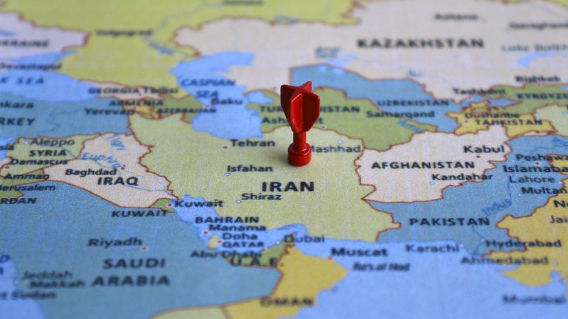
Many people asking "how big is Iran" are surprised by just how large the country really is. Iran covers about 636,000 square miles (1.65 million square km), making it the 18th-largest country in the world and the second-largest country in the Middle East (after Saudi Arabia).

Located in western Asia, Iran sits at a strategic crossroads connecting the Middle East, Central Asia, and South Asia. Its size, geography, and population have played a major role in shaping the country's history and influence in the region.

Advertisement

Understanding Iran's size helps explain why the nation has long been a major political and cultural center stretching back to the days of ancient Persia.

How Iran Compares in Size

Iran's total land area of about 1.65 million square kilometers makes it larger than many people expect. The country is roughly one-sixth the size of the United States and about one-fifth the size of Australia.

Another way to visualize its scale is to compare it with American states. Iran is nearly as large as Alaska and more than twice the size of Texas. In fact, you would need to combine the areas of Texas, California, Montana, and Illinois to equal the landmass of Iran.

Advertisement

Compared with its neighbors, Iran is also massive. The country is about four times larger than Iraq and around 80 times larger than Israel.

Iran stretches approximately 1,025 miles (1,650 km) from north to south and about 1,125 miles (1,810 km) from east to west. Its longest diagonal distance from northwest to southeast reaches roughly 1,449 miles (2,333 km).

Advertisement

Iran's Location and Borders

Iran shares land borders with seven countries, reflecting its central position in western Asia. These neighboring nations include Iraq, Turkmenistan, Afghanistan, Pakistan, Azerbaijan, Türkiye, and Armenia.

The country also has long coastlines along three major bodies of water. Iran's northern shore borders the Caspian Sea, while the southern coastline stretches along the Persian Gulf and the Gulf of Oman. Together, these coasts total roughly 1,976 miles (3,180 km).

Advertisement

Because of this location between Central Asia, the Arab states of the Middle East and the Indian subcontinent, Iran has historically been a crossroads of trade, culture, and political power.

Mountains, Deserts, and the Iranian Plateau

Iran's landscape is diverse and dramatic. More than half of the country consists of mountains and deserts, with large ranges shaping its geography and climate.

The Zagros Mountains run for about 994 miles (1,600 km) across western Iran and form one of the country's most important geographic features. In the north, the Alborz Mountains rise sharply along the southern edge of the Caspian Sea.

Advertisement

Mount Damavand, located in the Alborz range, is the highest peak in Iran at 18,606 feet (5,671 m).

Between these mountain systems lies the vast Iranian plateau, a region of deserts, basins, and arid landscapes. Much of the country has a dry or semiarid climate, although the Caspian coast supports fertile plains and dense forests.

Advertisement

Population and Major Cities

Iran's population is estimated at about 92 million people. Most Iranians live in the western half of the country where the climate is milder and economic centers are located.

Tehran—the capital and largest city—serves as the political, cultural, and economic heart of the country. The city sits in the north near the Alborz Mountains and has grown into one of the largest metropolitan areas in the Middle East.

Advertisement

Iran's society is shaped strongly by religion and culture. The vast majority of Iranians practice Islam, which plays an important role in daily life and national identity.

Why Iran's Size Matters in History

Iran's large territory has shaped its history for thousands of years. Ancient Persian kingdoms controlled vast areas of land and trade routes connecting Asia, Europe, and the Middle East.

The Achaemenid Empire founded by Cyrus the Great in the sixth century B.C.E. marked the territorial height of Persian influence. Later dynasties such as the Safavid Empire helped shape the boundaries of the modern Iranian state.

Advertisement

In 1979 the Iranian Revolution led to the creation of the Islamic Republic of Iran, dramatically transforming the country's political system and establishing a government led by religious authorities under a supreme leader.

Because of its location, population, and vast oil and natural gas reserves, Iran remains one of the most strategically important countries in the region today.

We created this article in conjunction with AI technology, then made sure it was fact-checked and edited by a HowStuffWorks editor.

Advertisement

Advertisement

Loading...