Historical Events
From the Age of Enlightenment to the Christmas Truce, learn about some of history's most pivotal events.

5 Most Corrupt Presidents in U.S. History (Including a Civil War Hero)

10 of the Worst People in History: A Leadership Hall of Infamy

The Most Powerful People in the World Aren't Always the Richest

The Madden Curse Debate: NFL Legends Weigh In on the Phenomenon
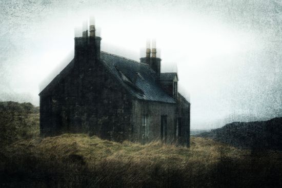
Most Haunted Places in the World: True Encounters and Tales

Is Santeria Considered Witchcraft? A Deep Dive into the Tradition

How Many Countries Are in Europe? Surprisingly Not a Simple Answer

Why Did the USSR Fall? The Real Costs of Becoming a Superpower

Why Did the Berlin Wall Fall?

There Are Castles in Ohio? No Foolin'?

10 Least Diverse States in the U.S.
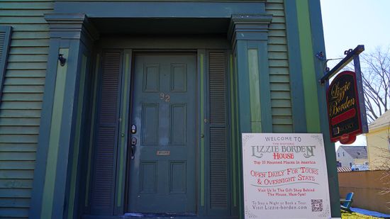
10 Most Haunted Places in America: Stanley Hotel, Queen Mary, and More

9 Countries That Start With L

3 (or 4) Countries That Start With R

Who Is Iran Allies With?

What Classifies a World War as, Well, a World War?

Hiroshima Shadows Preserve One of History's Darkest Moments
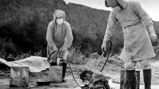
Unit 731: Inhumane Medical Experimentation During WWII
Learn More
When the Edmund Fitzgerald set sail on its final voyage, it was one of the largest ships on North America's Great Lakes. But by the evening of November 10, 1975, it had vanished beneath the waves of Lake Superior, taking all 29 crew members with it and cementing its place in maritime history.

In the world of deep-sea exploration and innovation, OceanGate once stood at the crossroads of cutting-edge engineering and daring adventure.
By Zach Taras

Malaysia Airlines Flight 370 disappeared in March 2014 as the Boeing 777 was en route to Beijing, China, leaving from Penang Airport in Kuala Lumpur, Malaysia.
By Mitch Ryan
Advertisement

The Bhopal gas tragedy is etched in history as the world's worst industrial disaster.
By Zach Taras
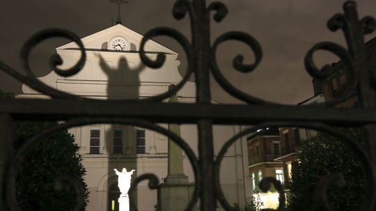
Discover the most haunted house in New Orleans, where ghostly legends, eerie encounters, and paranormal activity reveal the city's dark and mysterious past.
By HowStuffWorks

Explore the most haunted houses in Alabama, where ghostly encounters, eerie legends, and paranormal activity bring the state’s spookiest locations to life.
By HowStuffWorks

Discover the most haunted places in Pennsylvania, from eerie ghost towns to haunted asylums. Explore chilling legends and real paranormal encounters!
By HowStuffWorks
Advertisement
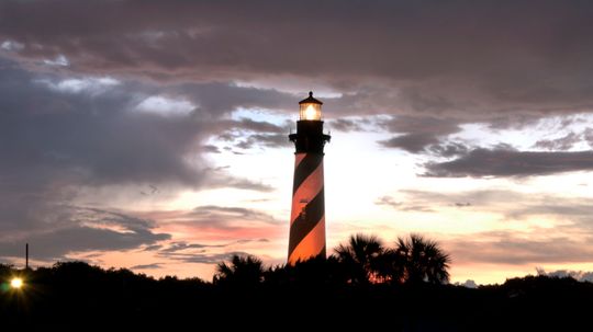
Explore the most haunted places in Florida, from eerie hotels to ghostly lighthouses. Discover chilling stories, paranormal hotspots, and haunted history!
By HowStuffWorks
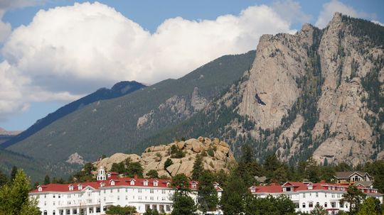
Discover the most haunted places in Colorado, from ghostly hotels to eerie abandoned towns. Explore chilling paranormal stories and spine-tingling encounters!
By HowStuffWorks

The Itaewon Halloween tragedy sent shockwaves through South Korea and the world in October 2022, turning a night of joy into a devastating disaster.
By Yara Simón
Discover the most haunted places in Indiana, from eerie asylums to ghostly mansions. Explore paranormal hotspots with chilling histories and spooky sightings!
By HowStuffWorks
Advertisement

Discover the most haunted houses in Tennessee, where eerie encounters, ghostly legends, and paranormal activity bring chilling stories to life. Dare to explore?
By HowStuffWorks

Explore the most haunted houses in Chicago, from eerie mansions to ghost-infested hotels. Discover chilling ghost stories and paranormal encounters.
By HowStuffWorks
Discover the most haunted places in California, from eerie hotels to ghostly landmarks. Explore chilling paranormal stories and legends from the Golden State!
By HowStuffWorks

Explore the most haunted hotels in Chicago, where ghostly encounters, eerie legends, and paranormal activity make for a chilling stay. Dare to check in?
By HowStuffWorks
Advertisement

Explore the most haunted hotels in San Antonio, where ghostly legends, eerie encounters, and chilling history make for a spine-tingling stay.
By HowStuffWorks

Explore the most haunted hotels in Savannah, Georgia, where ghostly encounters, eerie legends, and paranormal activity make for a spine-chilling stay.
By HowStuffWorks

Discover the most haunted houses in Connecticut, where eerie ghost stories, paranormal activity, and chilling history make these locations truly terrifying.
By HowStuffWorks

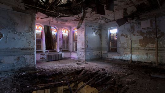
Discover the most haunted places in Michigan, from eerie asylums to ghostly hotels. Explore real paranormal hotspots and chilling legends across the state.
By HowStuffWorks
Advertisement

The Sewol Ferry tragedy remains one of the most devastating events in South Korea's modern history. On April 16, 2014, the MV Sewol, an ill-fated ferry carrying 476 passengers, capsized during a routine trip to Jeju Island. Among the passengers were 250 high school students from Danwon High School on a field trip, making the tragedy even more heartrending.
By Mack Hayden

The Hillsborough tragedy is one of the darkest chapters in British sporting history. On April 15, 1989, 96 Liverpool supporters lost their lives during an FA Cup semi-final between Liverpool and Nottingham Forest at Hillsborough Stadium in Sheffield. What began as an exciting day for fans turned into a catastrophic event that would forever change football and its approach to safety.
By Yara Simón

On February 25, 2022, an underwater maintenance exercise at the Pointe-a-Pierre oil pipeline turned catastrophic, claiming the lives of four divers. The Paria diving tragedy, which involved the Paria Fuel Trading Company, shook the region and raised critical questions about safety protocols and emergency response.
By Yara Simón

Discover the chilling tales of haunted hotels in New Orleans. Uncover ghostly legends, eerie histories, and paranormal hotspots in this spooky Southern city.
By HowStuffWorks
Advertisement

Sometimes, history can seem to pivot on a single event. While the underlying causes were numerous, historians generally accept that the assassination of Archduke Franz Ferdinand was the most significant single inciting act of World War I.
By Zach Taras

Spite is not just for kids with broken toys. Many adults have gone to unbelievable lengths to pay back someone who did 'em wrong. Here are 10 classic examples.